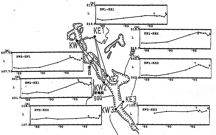
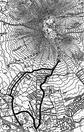
USU VOLCANOOBSERVATORY
Ê


1998 MT. KOMAGATAKE ERUPTION
Ê

Linkto Photo Collection

The Eruption Recorded by Seismometers

Leveling and EDM Survey

Temporal Changes in Underground TemperetureÊ

Features of Eruption Activities for Last200 Years


The Eruption Recordedby Seismometers


Ê


return to top


Ê


Leveling Survey
Ê

Leveling Route

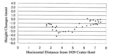
Relative height changes referred to KO1050 versus distance from 1929crater. (period from May 1998 to Oct. 1998 including Oct. 25 eruption)
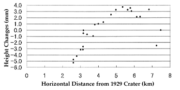
Relative height changes referred to KO1050 versus distance from 1929crater. (period from Mar. 5, 1996 eruption to Oct. 1998 eruption)

return to top


Ê


EDM Survey
Ê

EDM network around the large fissure in the summit and Temporalchanges in the length of baseline

Return to Top


Ê


Temporal Changesin Underground Tempereture across F10
Ê

Map showing 1929 main crater, the 1942 large fissure, the 1996 pitcrater and the 1996 fissure crater on the summit.

Return To Top


Ê


The Eruption Activitiesof Mt. Komagatake for last 200 years
(for prediction of a large eruption)
Ê

Return to Top